

Maps
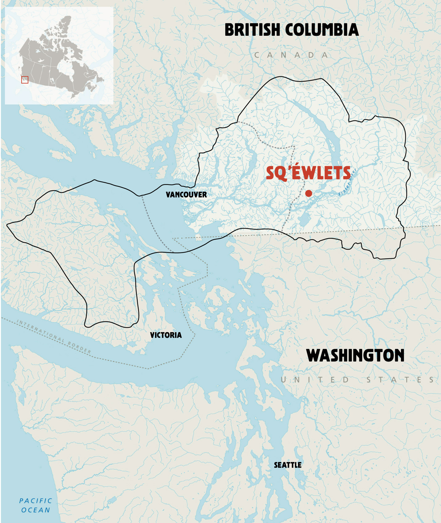
Our Sq’éwlets community is a tribe of the larger collective of Stó:lō. We are Coast Salish people, like our downriver relations Katzie and Musqueam, and our Vancouver Island relations, Stz'uminus and Snuneymuxw. The ancestral lands of our collective Coast Salish Nations are located in the Pacific Northwest of North America. More specifically, our territories are situated in the lower Fraser River watershed and part of the broader Puget Sound and Salish Sea (Gulf of Georgia) Region. Our Coast Salish Nations are connected by way of our shared geography, language, culture, families and history.
There are three regional maps below.
Coast Salish Territory in the Pre-Contact Era
The first map shows Coast Salish Territory in the Pre-Contact Era, before the arrival of Xwelítem (European settlers). Before the late 18th century, all of this land was the territory of First Nations Peoples. You see where our Sq’éwlets community is located, a general boundary of Coast Salish territory, and the general divisions of Upriver, Downriver, and Island Salish Nations (see the Halq̓eméylem language map for more detail).
Coast Salish Territory in the Pre-Contact Era
- British Columbia - Canada
- Vancouver
- Victoria
- Sq’éwlets
- Washington - United States
Coast Salish Territory in the Post-Contact Era
The second map shows Coast Salish Territory in the Post-Contact Era, after the arrival of Xwelítem (European settlers). You see how the land is parceled into reserve lands. Our Sq’éwlets Band Office is located (see Our Sqwélqwel Places for a photo view) along the mid-Fraser River. All the cities and First Nations Reserves from Yale upriver to Vancouver downriver are shown.

Coast Salish Territory in the Post-Contact Era
Legend
- Parkland
- Present-day First Nations Reserves
- Scowlitz First Nations
First Nations Language Communities of the Pacific Northwest
The third map shows the First Nations Language Communities of the Pacific Northwest. This gives you an idea of how many First Nations live in this area today and their ancestral roots here. Many of these communities are our relations, trade partners, competitors in sport, and kinfolks in the longhouse.
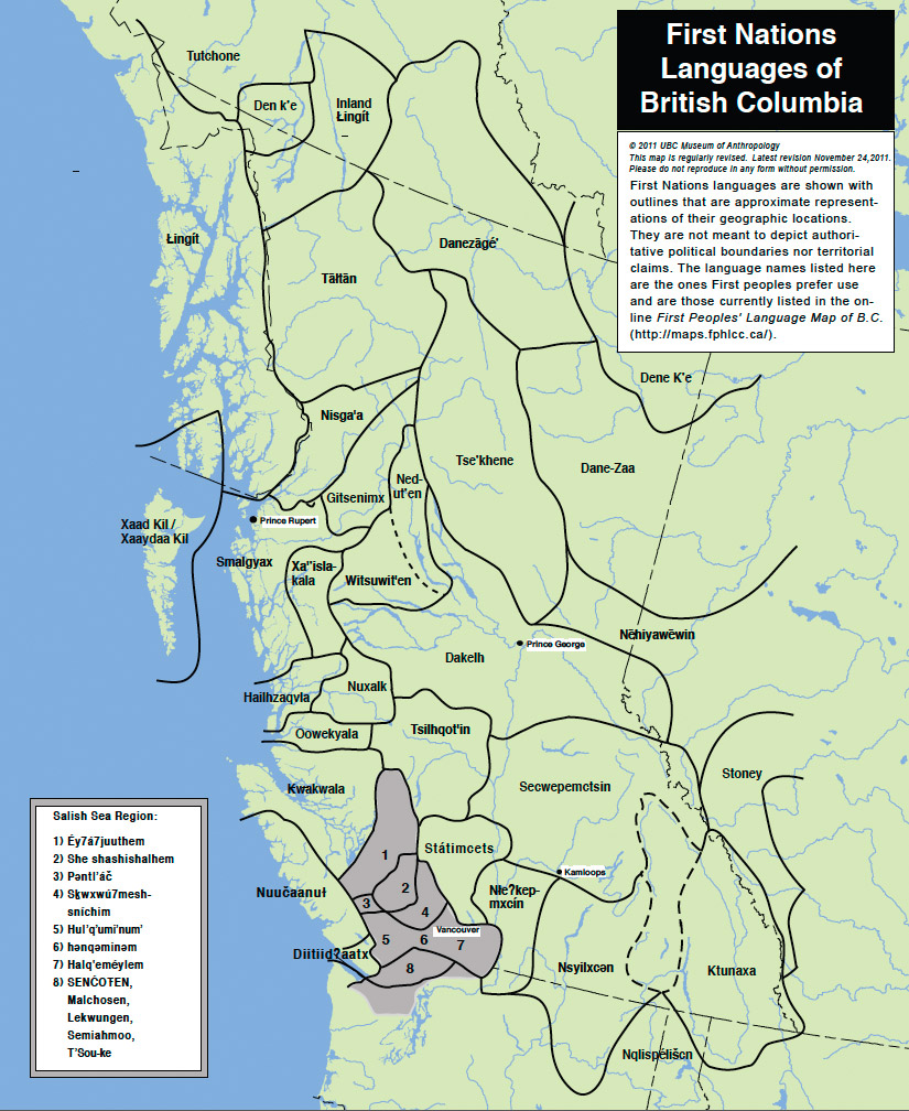
First Nations languages are shown with outlines that are approximate representations of their geographic locations. They are not meant to depict authoritative political boundaries nor territorial claims. The language names listed here are the ones First peoples prefer to use and are those currently listed in the online First Peoples' Language Map of B.C. (http://maps.fphlcc.ca/)
First Nations Languages of British Columbia
First Nations languages are shown with outlines that are approximate representations of their geographic locations. They are not meant to depict authoritative political boundaries nor territorial claims. The language names listed here are the ones First peoples prefer to use and are those currently listed in the online First Peoples' Language Map of B.C. (http://maps.fphlcc.ca/)
- Tutchone
- Den k'e
- Inland Lingit
- Lingit
- Taltan
- Danezage
- Dene K'e
- Dane-Zaa
- Tse'khene
- Ned-ut'en
- Gitsenimx
- Smaigyax
- Xa'isla-kala
- Witsuwit'en
- Dakelh
- Nehiyawewin
- Hilhzaqvia
- Nuxalk
- Oowekyala
- Kwakwala
- Tsilhqot'in
- Secwepemctsin
- Stoney
- Nuucaanut
- Diitiid?aatx
- Statimcets
- Nte?kepmxcin
- Nsyilxcen
- Nxyilxcen
- Nqlispeliscn
Salish Sea Region
- Ey7a7juuthem
- She shashishalhem
- Pentl'ac
- Skwxwu7mesh-snichim
- Hul'q'umi'num
- henqeminem
- Halq'emelem
- Sencoten
- Malchosen
- Lekwengen
- Semiahmoo
- T'Sou-ke
