
Ancestor Mound 1
-
BEFORE EXCAVATION
See what a Mound One
looked like before excavation-
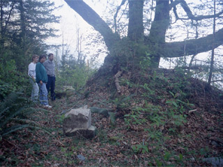 Three archaeologists standing at Ancestor Mound 1
-
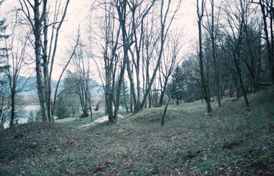
 Earthen ancestor mound at Qithyil
-
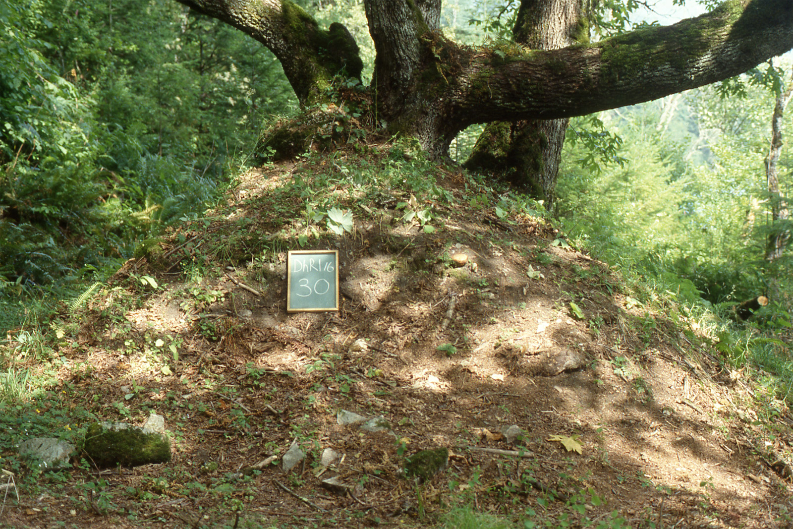
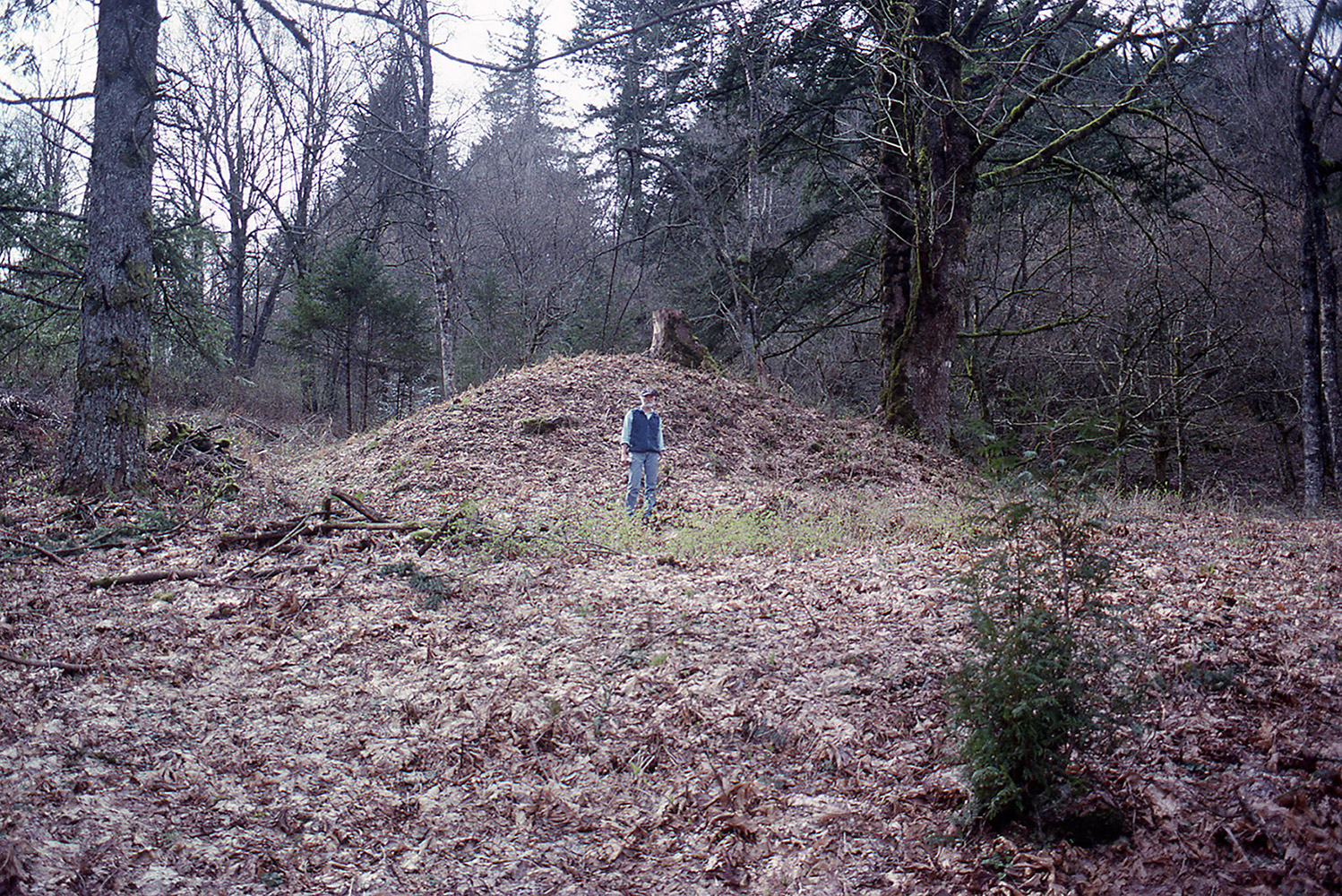
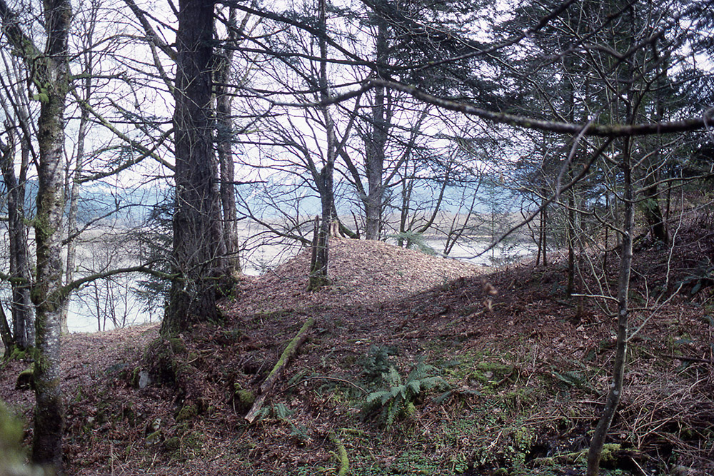
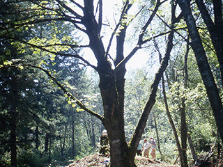
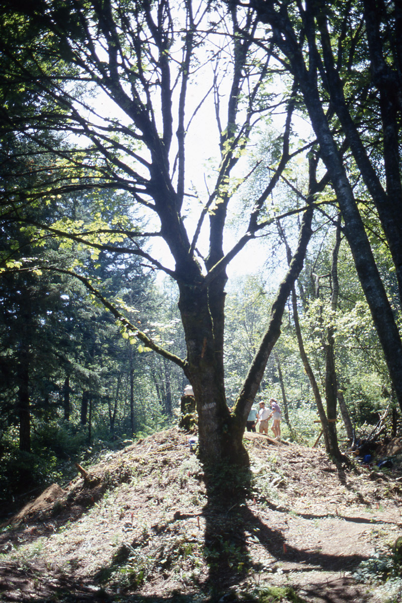 A large maple tree on top of Ancestor Mound 1
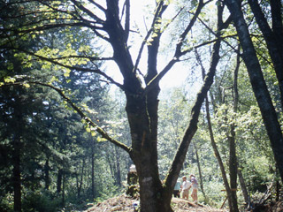
-
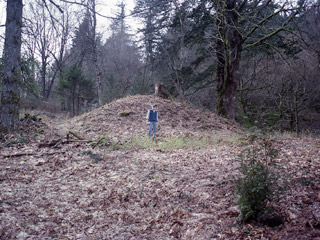
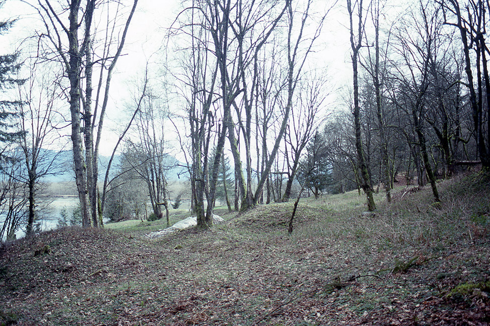
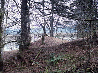
 Ancestor Mound 1 covered in brush and trees
-
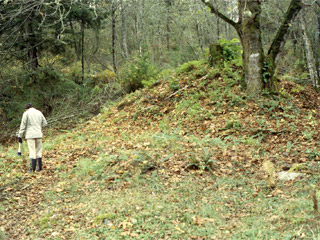
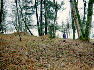
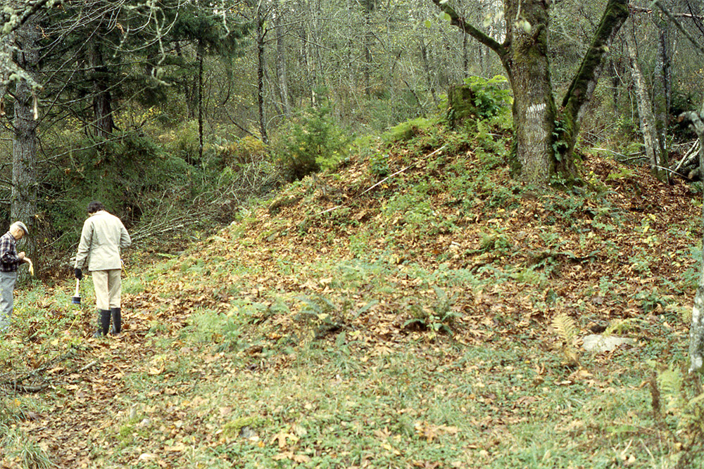
 An archaeologist standing in front of Ancestor Mound 1
-
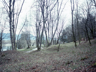 Earthen ancestor mounds on the terrace at Qithyil
-
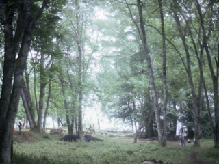
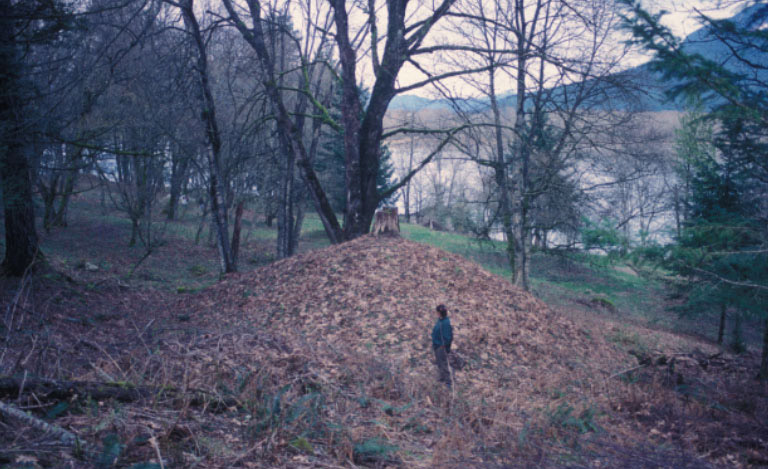
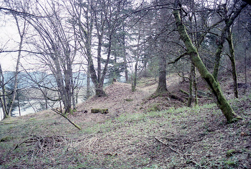
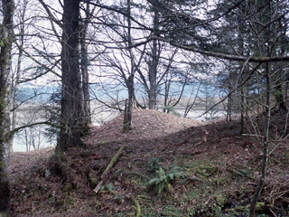 An ancestor mound seen through trees
-
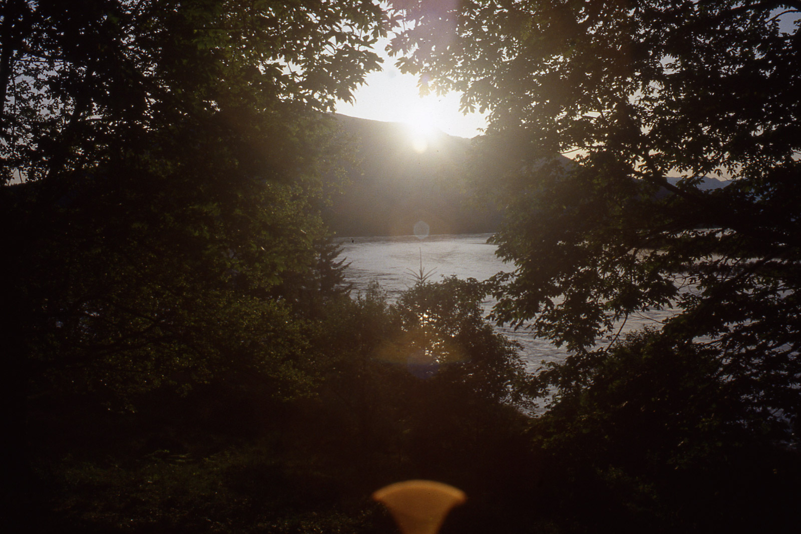
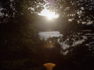
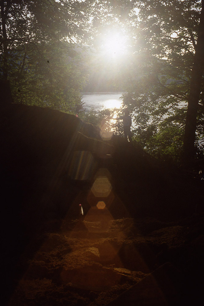
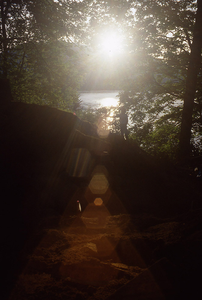
 Summer solstice sunrise over the Harrison River viewed from Qithyil
-
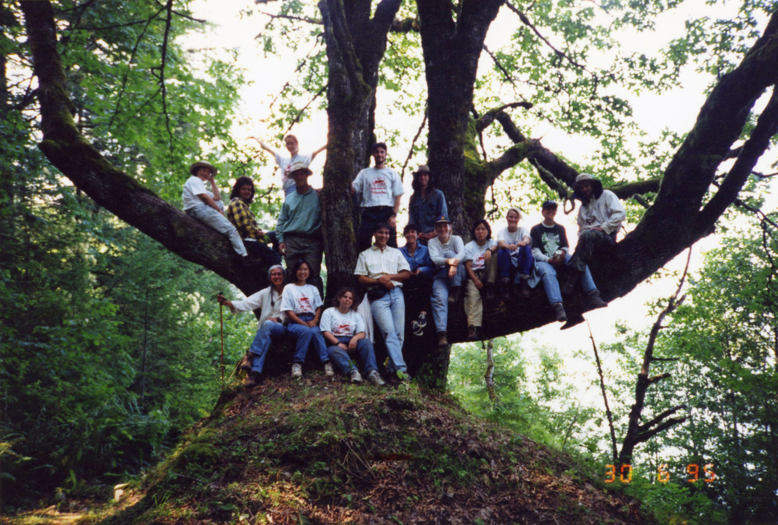
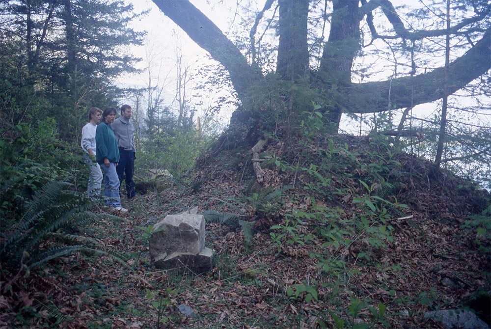
 Standing among ancestor mounds at Qithyil
-
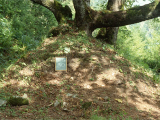
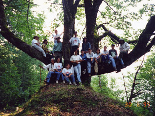 Photo op at the picture tree
-
-
AFTER EXCAVATION
See what a Mound One
looked like during excavation-
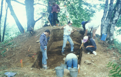
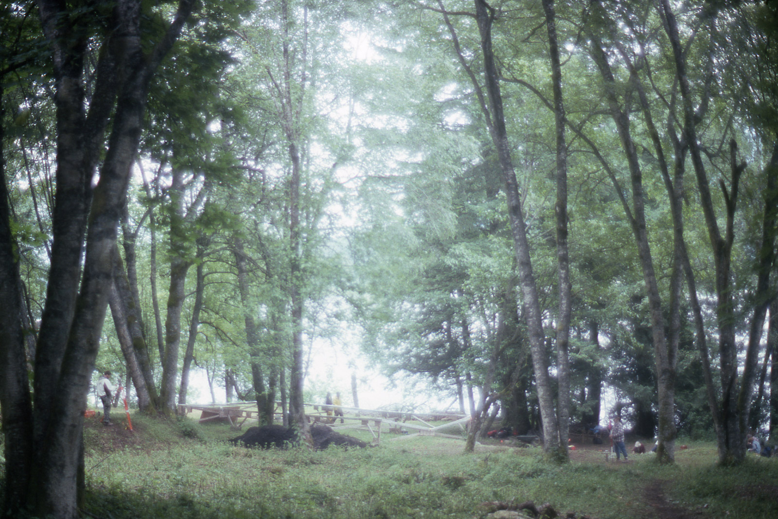
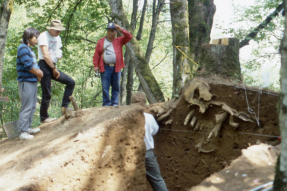
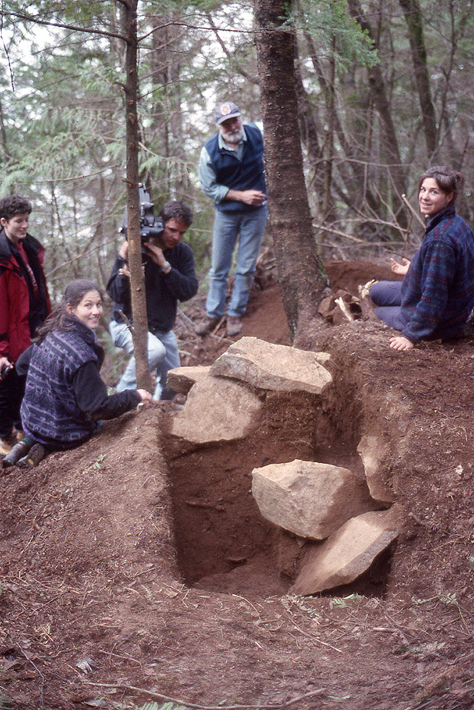
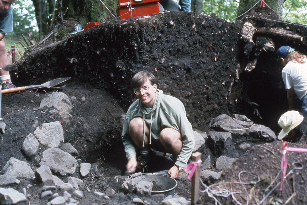
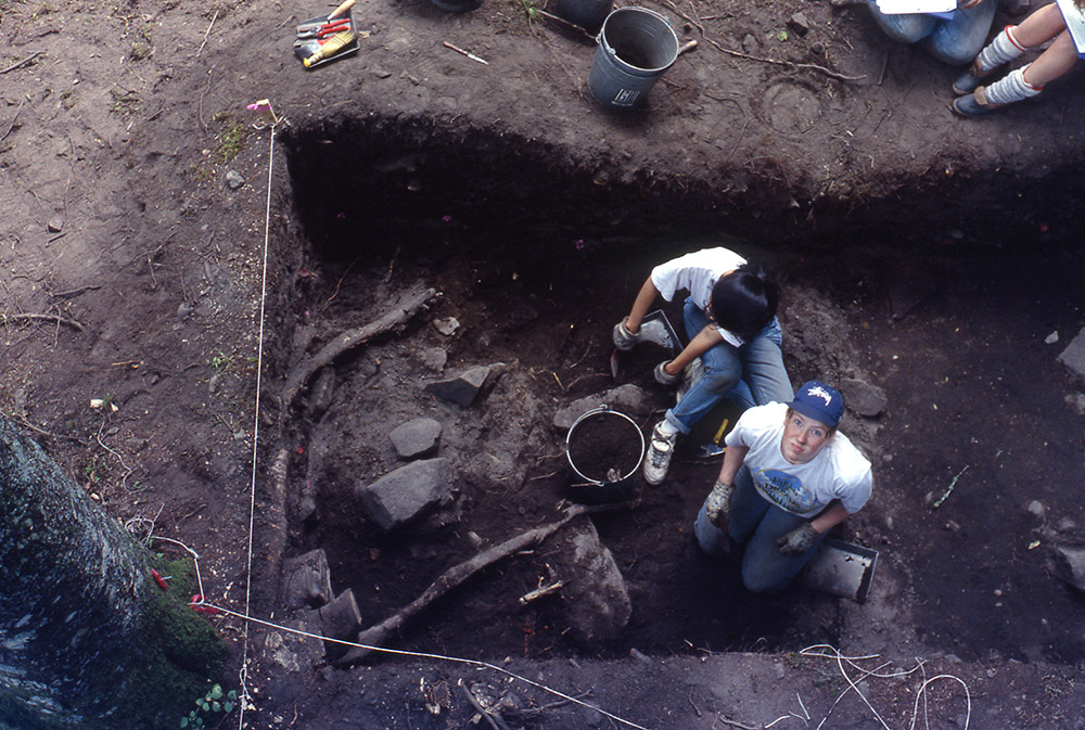
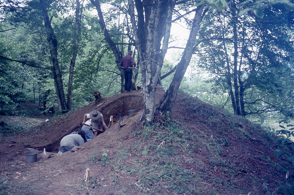
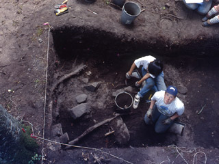 Two archaeologists in the process of excavating an ancestor mound
-
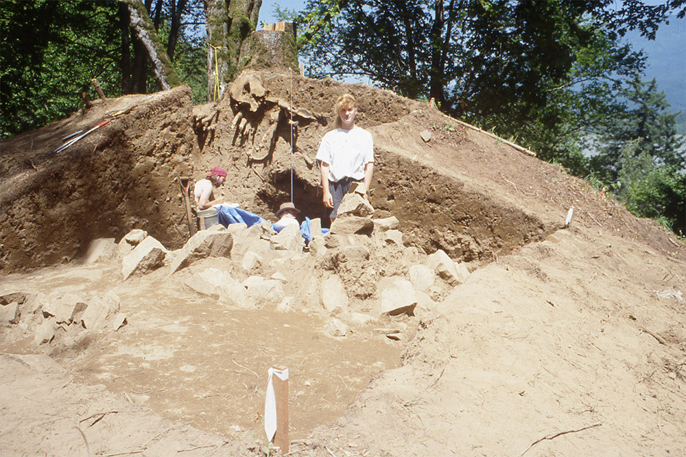
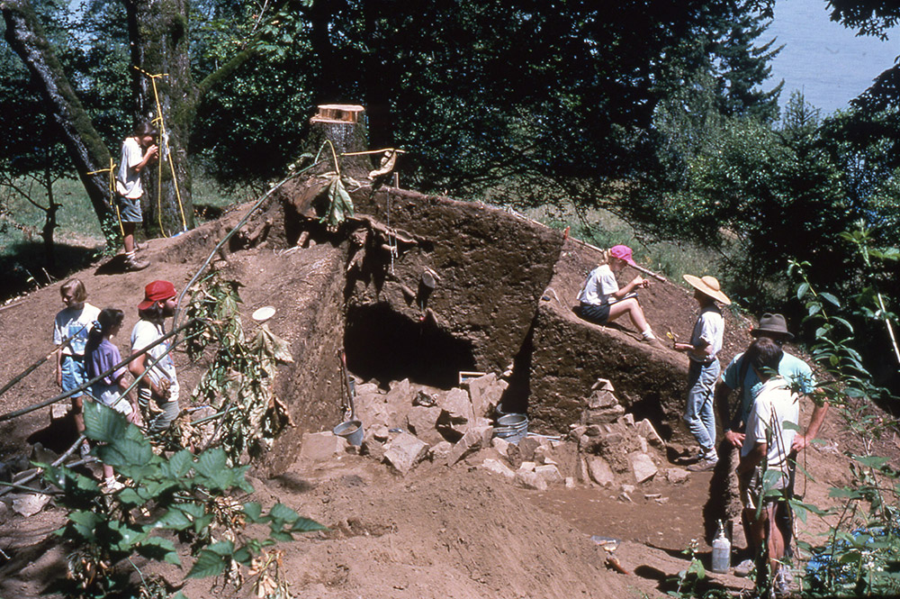
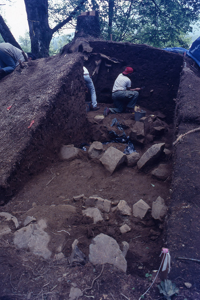
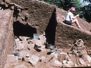 Ancestor Mound 1 during excavation
-
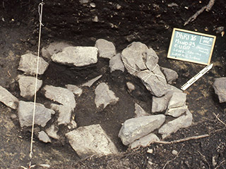
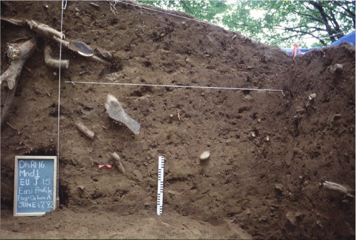
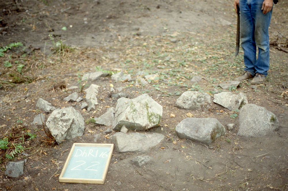
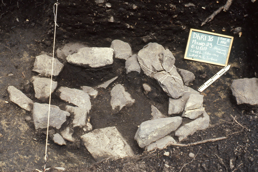
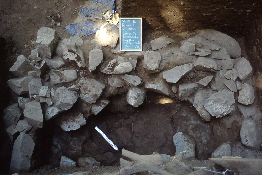
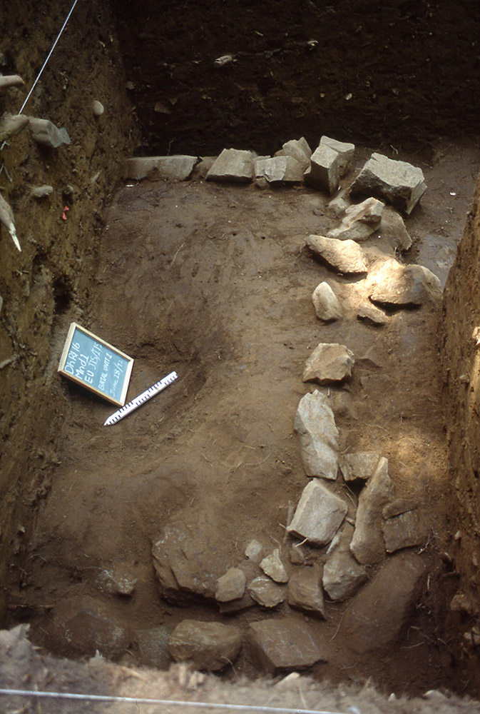
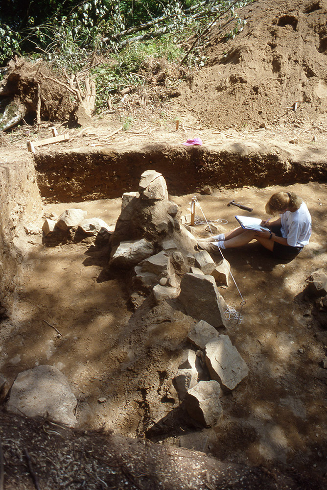
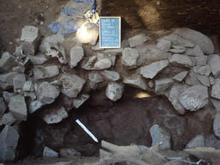 Exposed stonework within Ancestor Mound 1
-
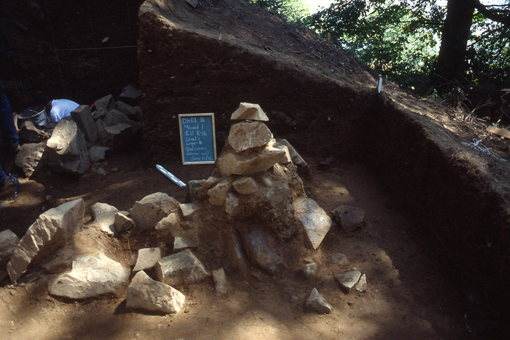
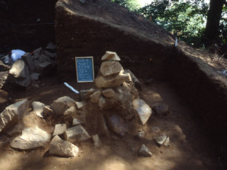 A exposed stone cairn marking a corner of Ancestor Mound 1
-
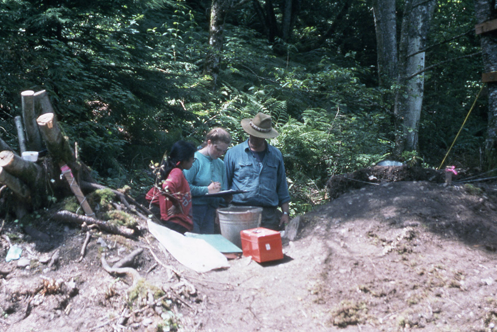
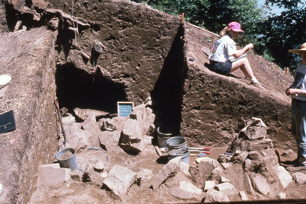
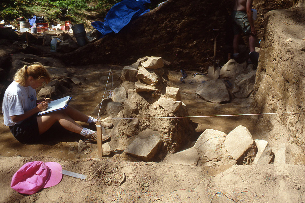
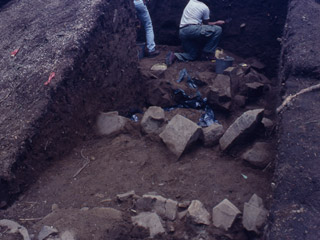 Archaeologists working on Ancestor Mound 1
-
 Earthen ancestor mounds on the terrace at Qithyil
-


The earthen mounds that our ancestors built to honour their deceased loved ones are not unique to our community. Our Coast Salish relatives built similar ancestor monuments along the lower reaches of the Fraser River at Musqueam and Hatzic, to the Chilliwack Valley, and upriver to the Fraser Canyon. Large ancestor mounds were also built by Coast Salish communities further afield on southeastern Vancouver Island and the Sunshine Coast north of Vancouver. Some of our dear siya:m (honoured leaders) were put to rest with copper ornaments like those that accompany the Chief in Ancestor Mound 1 at Qithyil. Together, as Sq’éwlets, Stό:lō and Coast Salish people, we have shared a common understanding about how to take care of our departed loved ones for the past thousand years.
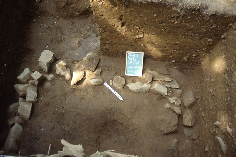
Ancestor Mound 1 is the largest and most impressive of all the mounds at our most important ancestral site, Qithyil. It is three meters high and twelve meters on each of its four sides. It took a great deal of work to prepare this mound. Our ancestors began by laying a clay floor. They dug a shallow pit at the centre and carefully placed their relation there. They built a square stone cairn or rock pile over their ancestor with over 200 boulders. They then built a square rock wall around the edges with large stone stacks in the corners. These features are similar to other large mounds in the area. This includes mounds described by Charles Hill-Tout in 1899 and other 20th century anthropologists. Because of the work at Qithyil, archaeologists and First Nations communities are now identifying ancestor mounds throughout the Northwest Coast.
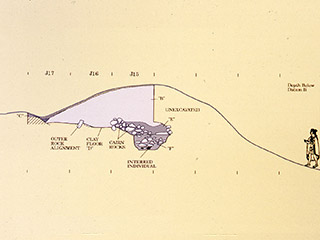
Mound 1 was made of earth to cover the grave of a man who was interred here about 1400 years ago

- Stone Perimeter Alignment
- Burial cairn


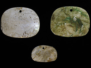
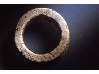
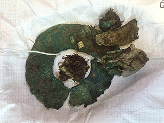
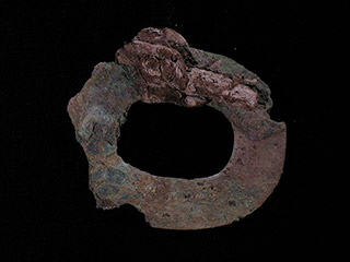
The ancient person laid to rest in Ancestor Mound 1 was a man. He was placed on his right side hugging his legs and facing northeast. He was wrapped in cedar bark and leather blankets. He was put to rest with many treasures: four copper discs strung around his neck with leather, a large copper ring, four abalone pendants, and about seven thousand beads of sliced dentalia shell around his neck.


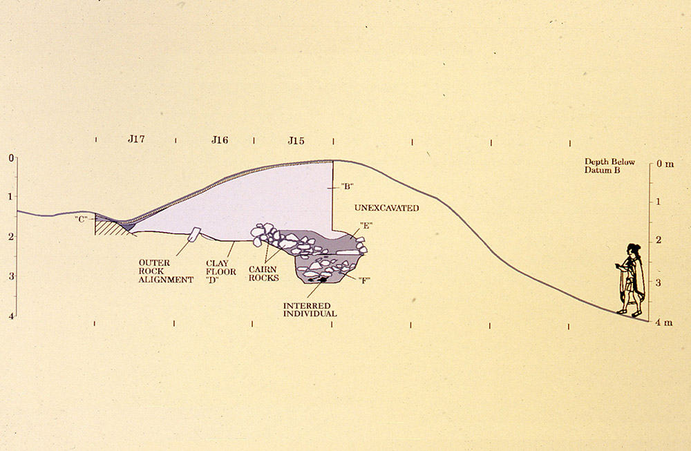
- Alignement de pierres extérieures
- Plancher en argile
- Personne enterrée
- Non fouillée
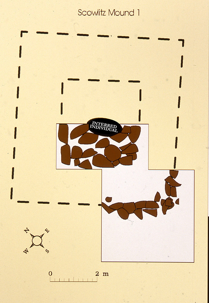
- Scowlitz Mound 1
- Interred Individual
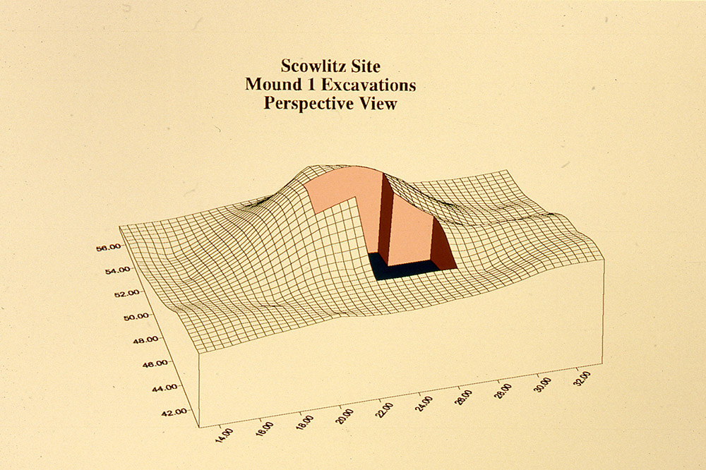
- Scowlitz Site
- Mound 1 Excavations
- Perspective View
Betty Charlie, our Sq’éwlets Elder, was part of this work. She states:
[B]ack then, they did have royalty in their families…Mound 1 [was] nine feet high and he (the ancestor) was all geared down with…copper, dentalia beads…he had everything on.
This was clearly an important man in ancient Sq’éwlets society. A lot of people were needed to build this ancestor mound. Some of these people had special knowledge of how to build the mound and to bless this person. After our excavations, this man was honoured in a ceremony that returned him to the earth. . This ceremony was done by a Stó:lō spiritual person named Vincent Stogan, from the Musqueam community near Vancouver. Ancestor Mound 1 itself was also returned to the way it had been found. Our community honoured this man with a burning ceremony and feast, both ancient traditions of the Stó:lō community.
View More Ancestor Belongings | View All


Ancestor Mound 1 Solar Alignment

The view from the back of Ancestor Mound 1 looking across the river to Mount Woodside where the sun rises on the morning of the summer solstice (June 21st-the beginning of summer). All of the ancestor mounds at Qithyil have this same orientation to summer solstice sunrise, the point at which the sun reaches its farthest movement north before returning on its journey south for the winter.
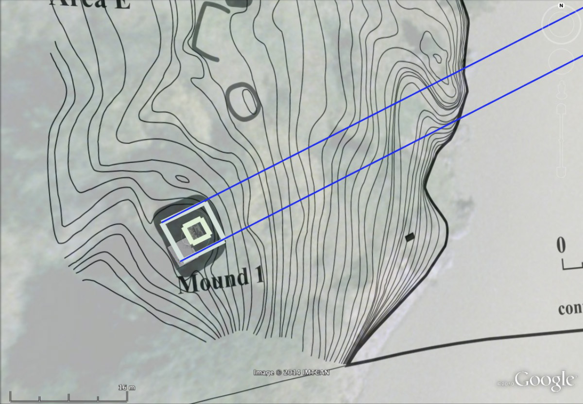
This map of Ancestor Mound 1 at Qithyil shows how precisely the shape of the mound and the stone walls buried inside it are aligned (blue lines) to the location of the sunrise on the distant horizon on the day of the summer solstice, June 21st, – the longest day of the year and the beginning of summer.
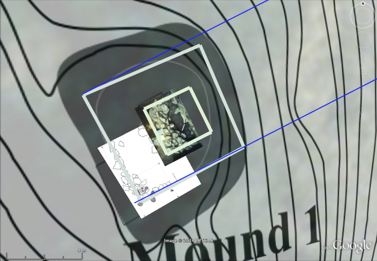
This close-up view of Mound 1 shows how our ancestors built this monument so that it faced directly towards the rising sun on the summer solstice (June 21st). The person interred here was placed on his left side and faced towards the east where the sun rises on this date.
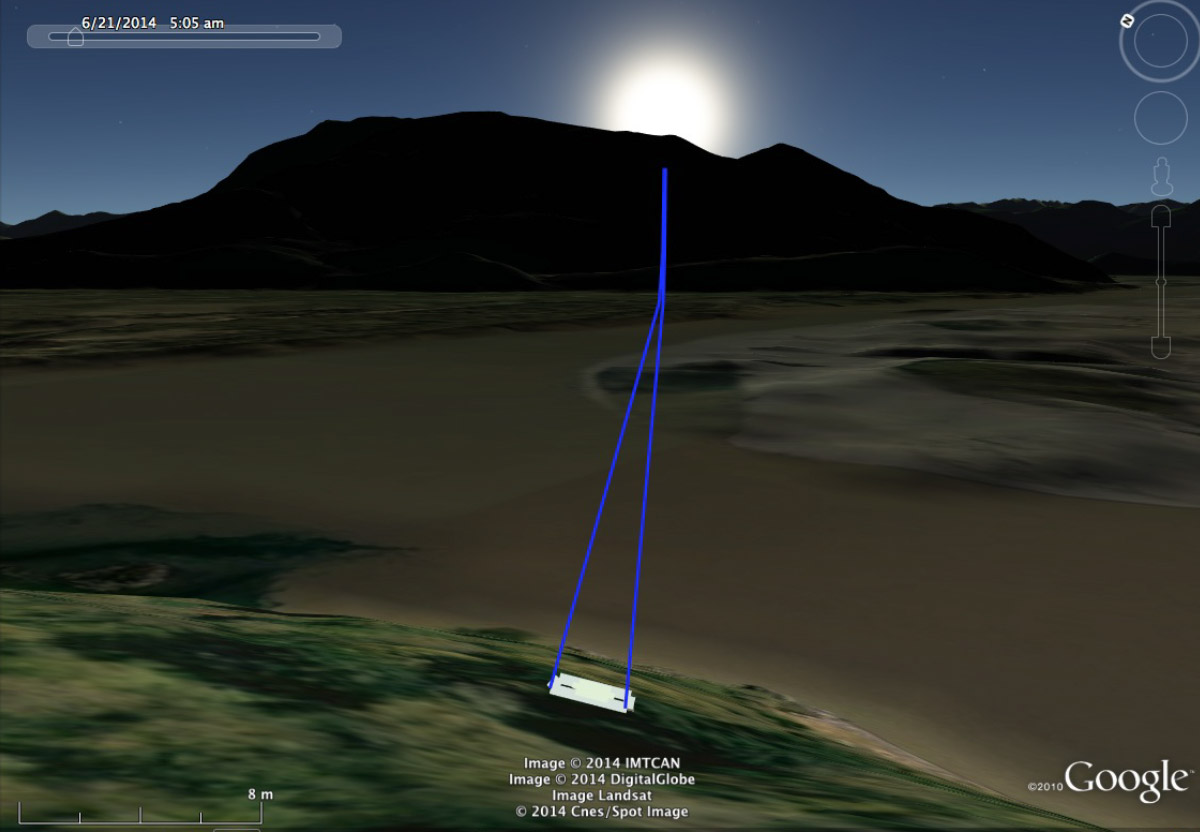
Google Earth view of summer solstice sunrise (June 21st) looking towards Mt. Woodside as seen from behind Ancestor Mound 1.
Ancestor Mound 1 Excavation Diagrams
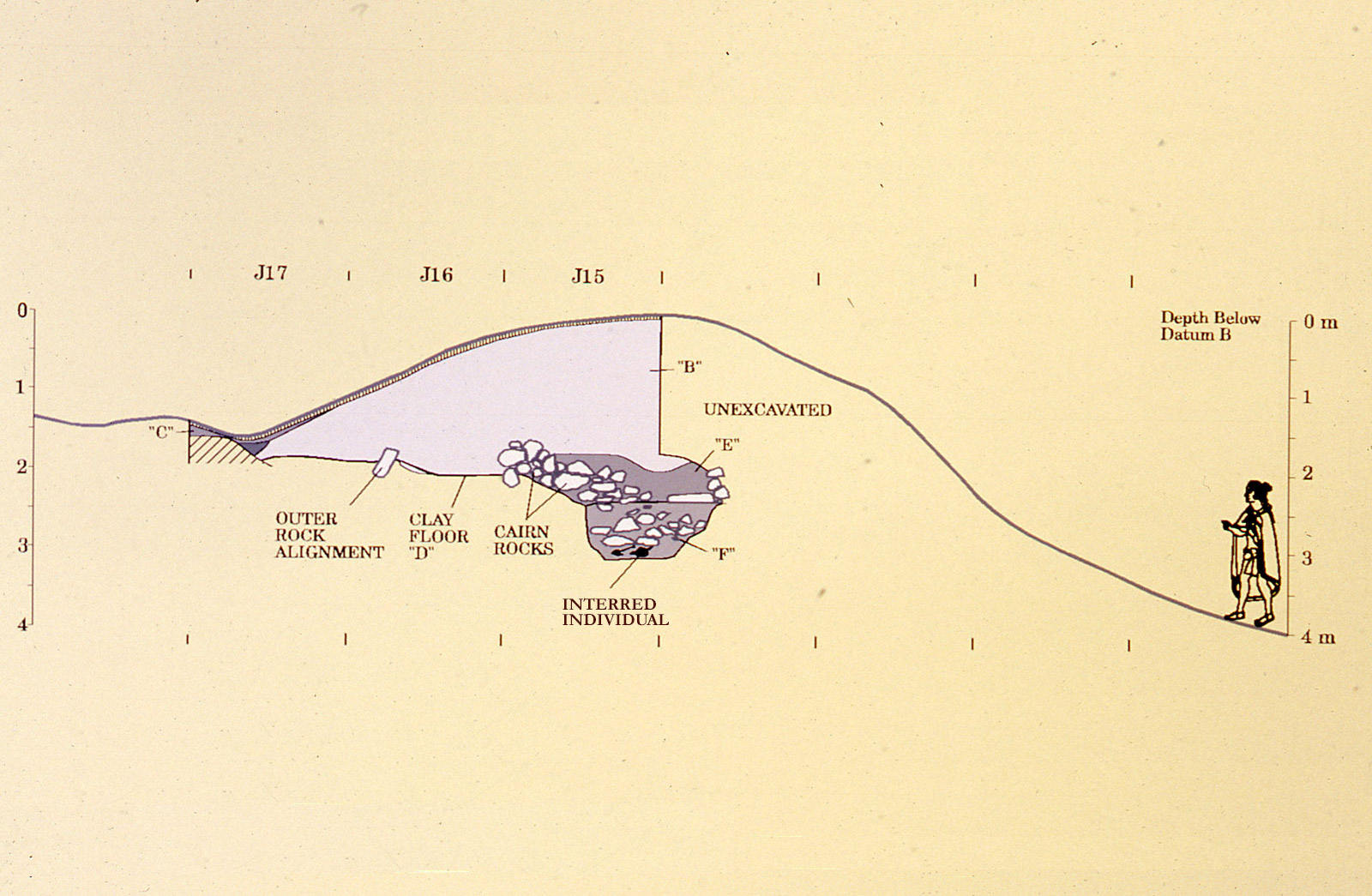
Cutaway of Ancestor Mound 1 showing its internal structure and the placement of the individual interred here
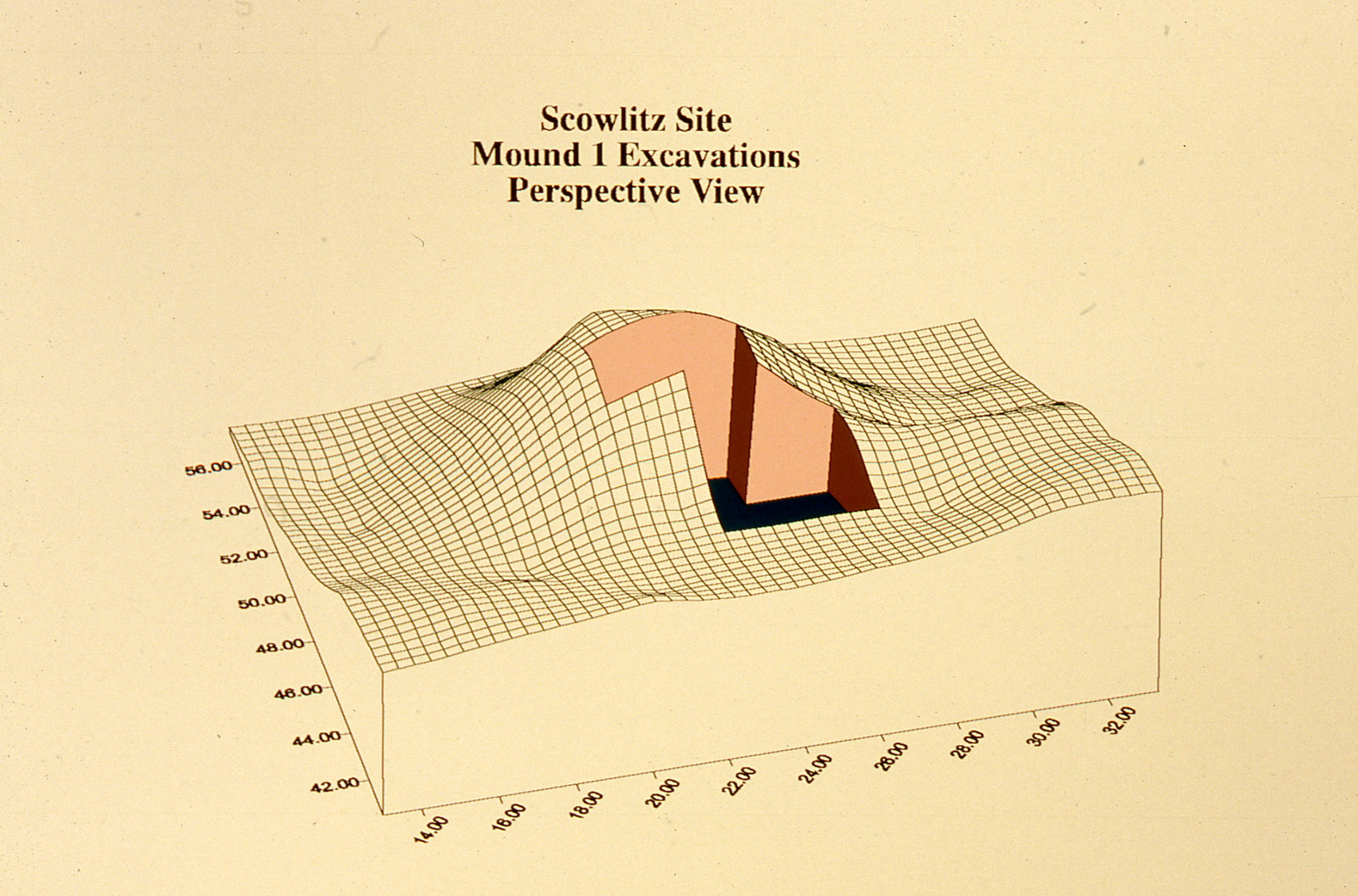
Diagram showing the contours of Ancestor Mound 1, approximately 3m high by 15m on a side, which was built by the ancient Qithyil community
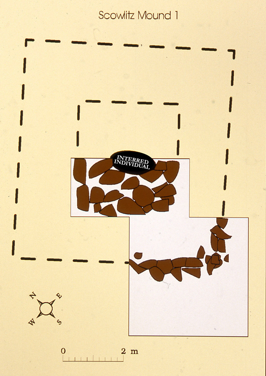
Internal rock alignments of Ancestor Mound 1 and the placement of the individual at centre